
Show the setting without suggesting a survey
A view from above can connect the building, pool and approach. It can also make neighbouring buildings and changes in level easier to understand.
It does not verify legal boundaries, land area or access rights. Those details require the appropriate property documents, not an interpretation of the image.
Real aerial work in different settings
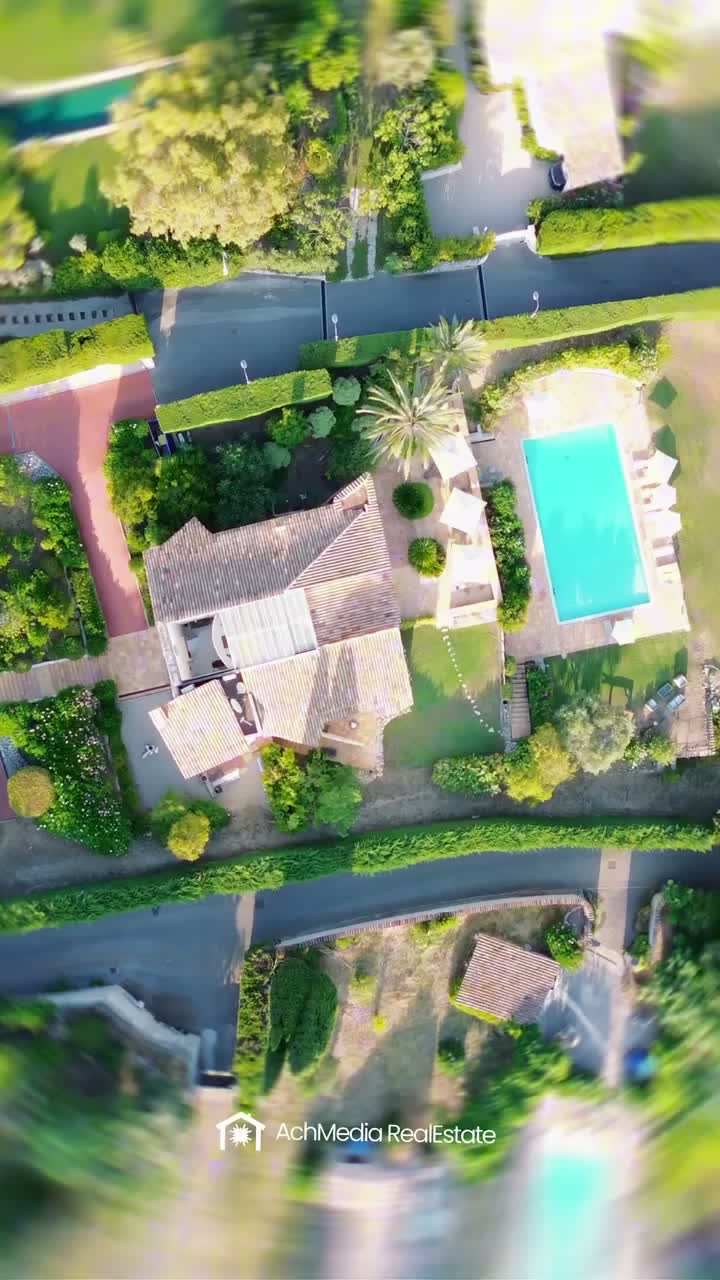
Saint-Paul-de-Vence, French Riviera
Villa St. Maxime
A top-down view shows the villa and pool together. The companion film places the location within the surrounding hills.
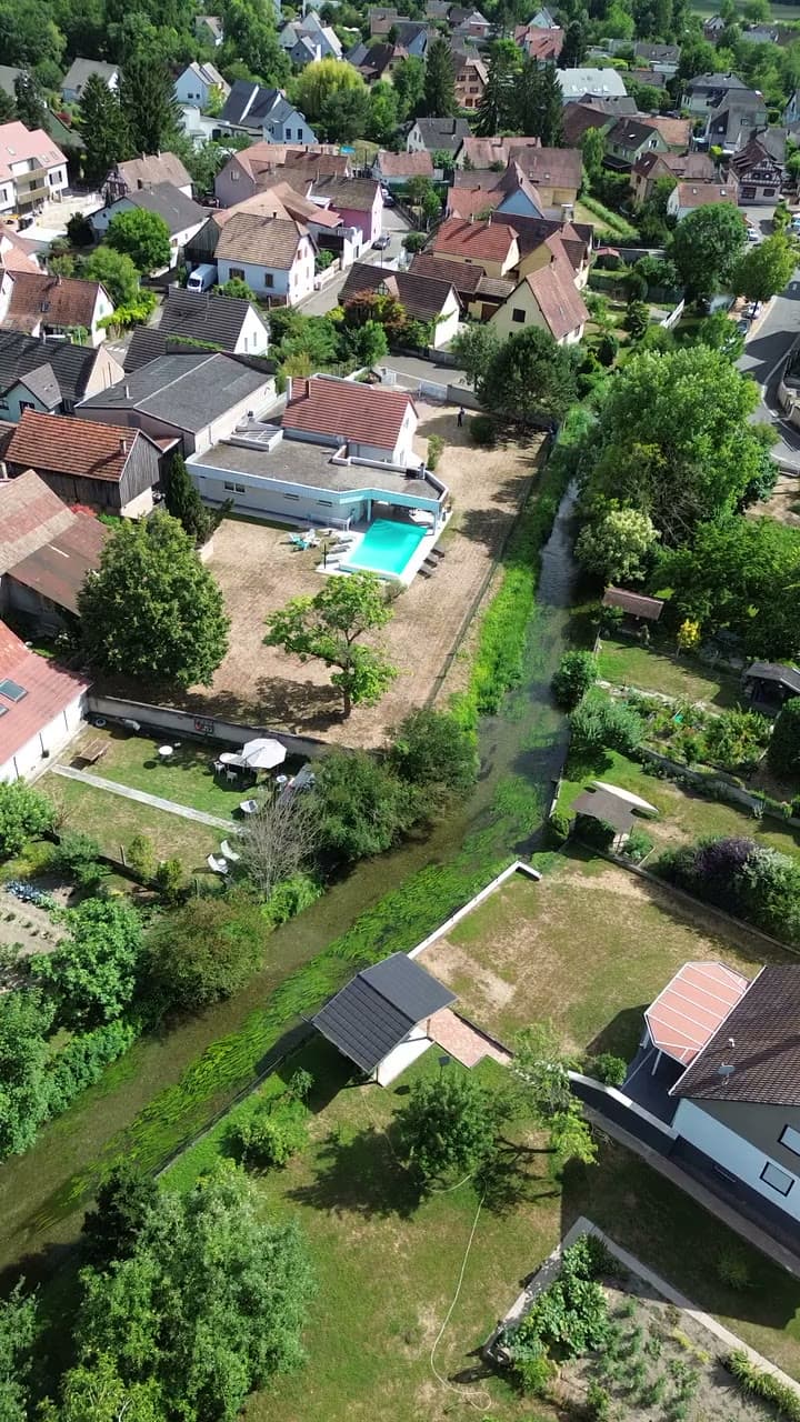
Plobsheim, Alsace
Villa La Digue
The aerial view relates the villa to its grounds and the river. Interior footage then shows the spaces the drone cannot explain.
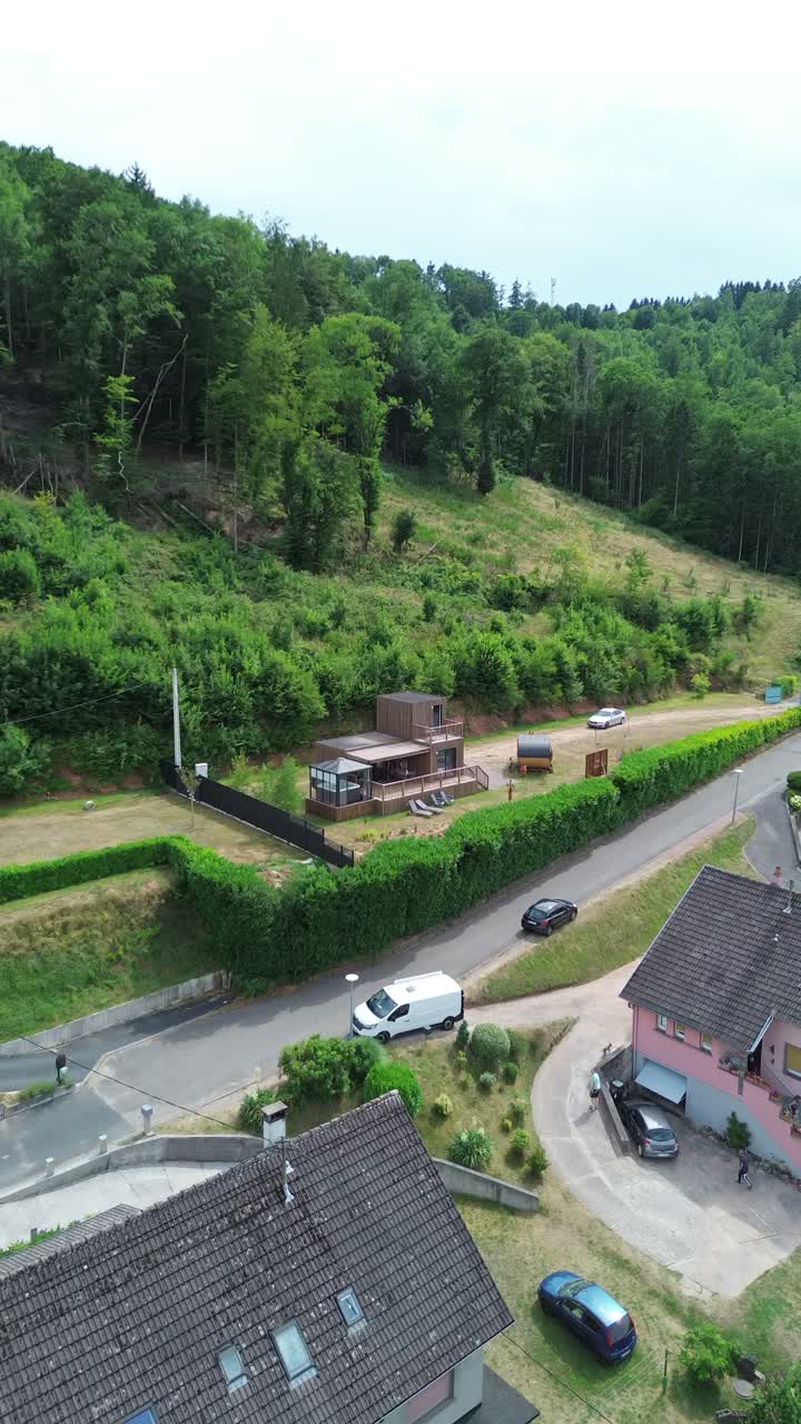
Rosteig, Northern Vosges
Aux Sons des Cloches
The chalet sits within a sloping setting. The aerial shot makes that relationship visible before the viewer studies the property page.
Feasibility comes before the shot list
The French aviation authority's guidance distinguishes operating categories and location restrictions. Commercial filming does not automatically determine which category applies.
Flight feasibility depends on the aircraft, operation and airspace. The owner's agreement to film does not remove aviation restrictions.
The brief must also address people present, privacy and material that should stay out of the published frame. No unrestricted flight is promised.
Check the location
Identify the property, surrounding airspace and access conditions. Confirm whether the proposed aerial sequence is feasible.
Plan the flight window
Consider light and operating conditions. Agree how weather or access changes affect the schedule and ground filming.
Film the relationship
Capture the building and its setting from agreed viewpoints. Keep the ground sequence within the same production brief.
Review what will be published
Check the edit, location information and privacy boundaries. Deliver only the versions covered by the agreed rights.
What affects the drone filming quote
Site preparation, flight requirements and travel affect the scope. The edit and its relationship with ground footage matter as much as time in the air.
Set the aerial sequence within the full property film brief. Agree source-footage rights and publication channels before commissioning.
When a ground-level sequence is the better answer
If aerial filming cannot proceed, the film can use the entrance or an accessible upper-floor viewpoint. That alternative must be agreed, not mislabelled as drone footage.
The collection shows both exterior and interior work. Parcelle explains the contact route after a viewer opens the property page.
Frequently asked questions
Does every property film need drone footage?
No. Aerial footage is useful when it explains the setting. Rooms, circulation and interior light are usually better shown from the ground.
Can you film any property from the air?
No. The proposed flight must be assessed against the location, aircraft and operating requirements. Owner permission alone does not make a flight permissible.
Do commercial drone flights always require advance authorisation?
Not automatically. Requirements depend on the operating category and location. The relevant checks must be completed before a flight is confirmed.
What happens if flying conditions are unsuitable?
The flight does not proceed in unsuitable conditions. Any rescheduling or alternative ground sequence follows the arrangements agreed in the production brief.
How much does drone property video cost?
The quote reflects preparation, location requirements, travel, filming and editing. This page does not promise a flat price for every flight.
Can the aerial film confirm the property boundary?
No. A film shows visible features. It is not a boundary survey or evidence of ownership, access rights or land area.
Will we receive the original drone files?
Source footage is covered by the agreement. Confirm the files, permitted uses and any restrictions before commissioning the shoot.
Start with the location and the view you need.
Send the property details so flight feasibility and production scope can be assessed.
Discuss an aerial property film